


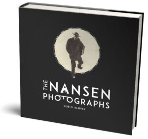
Description
The limited edition
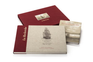
A boxed limited edition has been produced in 200 numbered sets. Each set includes a complete leather-bound copy of The Nansen Photographs and also a leather-bound companion volume Fridtjof Nansen’s Maps. The companion volume is made especially for the limited edition.
Fridtjof Nansen’s Maps
When Fridtjof Nansen left Norway for the Arctic on 24 June 1893 he brought with him a number of maps and charts. These were maps from previous expeditions to the area, but also published maps made by several of the World’s leading cartographers from Germany, England, Russia and the United States.
This book contains Nansen’s personal collection of maps brought on the Fram Expedition 1893–96, and also the main maps made based on the expedition’s own explorations.
The map collection gives a thorough insight into the exploration of the Arctic from 1734 to 1896, including handwritten and annotated maps, and rare charts given to Nansen by the Russian Government. They are accompanied by a chapter of notes describing the expeditions on which most of these maps are based.
The book has 112 pages in format 30 x 30 cm and contains 70 historical maps and charts.
Among the maps in the book are the Arctic expeditions of David Grey, Antonius de Bruijne, Adolf Erik Nordenskiöld, Adolphus Greely, James Booth Lockwood, F.J. Dorst, Henry Gore-Booth, Emil Bessels, A.P. Novosil’sky, John Rodgers, Thomas W. Long, Lieutenant Onatzewitsch, Edward Holm Johannessen, Benjamin Leigh Smith, Calvin Hooper, Karl Weyprecht & Julius Payer, Karl Koldeway, James Lamont, Fyodor Litke, Mikhail Reyneke, Stepan Moiseev & G. Rogachev, Ilya Berezhnykh & Petr Pakhtusov, Nikolay Krapivin & Avgust Tsivolka, Fyodor Rozmyslov, Elling Carlsen, Erik A. Ulve, Fritz E. Mack, P. Qvake, T. Torkildsen, Ivan Ivanov & Nikolay Ragozin, Stepan Malygin & Aleksey Skuratov, Stepan Muravjev & Mikhail Pavlov, Dmitriy Ovtsyn, Fyodor Minin, Alexandr Middendorf & Vasiliy Vaganov, Khariton Laptev, Semyon Chelyuskin, Vasiliy Pronchishchev, Petr Anzhu & Ilya Berezhnykh, Prokopiy Kozmin, Dmitriy Laptev, Ferdinand Vrangel & Fyodor Matyushkin, Gleb Shishmarev, Joseph Billings, Willy Kükenthal, Nils Christoffer Dunér, Fredrik Wilhelm von Otter, Theodor von Heuglin, Douglas Clavering, William Scoresby, Henrik Mohn, Cornelius Gisbert Zorgdrager, Charles Francis Hall, Frederick Schwatka, John O. Spicer, Franz Uri Boas, Fredrick William Beechey, George Strong Nares, George Washington De Long, Aleksandr Bunge & Eduard von Toll, Frederick George Jackson and Fridtjof Nansen.

Reviews
There are no reviews yet.